Friday, September 9, 2016

RonnieAdventure #0220 - Idaho, 2016 Part II

When pioneers on the Oregon Trail traveled through southern Idaho, they passed by "Beer Springs;" so named because the water tasted like Lager Beer -- only flat. Unfortunately the spring is now at the bottom of Alexander Reservoir; thus, current travelers can not stop and sample the "flat" beer. However, there are numerous other springs surrounding the community of Soda Springs that are located on public lands and are open to the public free of charge.

Hooper Springs Park is located just north of the community of Soda Springs and contains a nice covered "soaking pool," in addition to picnic tables and playground equipment.


Also located north of town are the Formation Springs and Cave Park, which is jointly managed by the Nature Conservancy and the U.S. Bureau of Land Management. The spring contains a high concentration of travertine (calcium carbonate) that forms pools and ledges in the stream-bed. There was reported to be a cave inear the spring, but the underbrush has grown so high that I could never find the cave entrance or the travertine pools!.

It is not possible to miss the entrance to Formations Springs Park because the road is marked by a "buck-and-pole" fence (the only one in the area).


The area around the community of Soda Springs contains some of the largest phosphate deposits in the world and, in addition to the areas being mined, there are an additional 50,000 reserve acres that have been identified as containing economically mineable phosphate. We drove by the Monsanto plant that processes phosphate from the local mines and we were informed that phosphate from the plant is primarily used for fertilizer and the herbicide RoundUp. Unfortunately, there are also 17 Superfund sites in the area from historic phosphate mining!


Located about a mile west of Soda Springs is the original townsite and the location of Camp Connor. The townsite was moved to its present location by Brigham Young in 1870 and all that remains of Camp Connor is a roadside marker. 


The old farming settlement of Bancroft is located on Highway 10 at the Chesterfield Road junction. Most of the stores in Bancroft have closed and the population is listed at just over 300 people.


The town of Chesterfield is north of Bancroft and was once a thriving Mormon community located directly on the Oregon Trail. Today, Chesterfield is a ghost town.

Unknown Source
In 1879 Chester Call settled in the area and then persuaded other relatives and church members to join him. As emigrants passed through Chesterfield, the local residents "fed the hungry, nursed the sick, replenished their supplies and exchanged fresh horses for weak or lame ones." However, with the coming of the railroad, Chesterfield faded into the sunset.

The Daughters of the Utah Pioneers have started a restoration project to restore and rebuild many of the old buildings. Free guided tours are offed throughout the summer months or you can obtain a map at the General Sore and take your own self-guided tour.

The guided tour meets at the Holbrook Mercantile General Merchandise building and the first stop is the Call-Muir Log Cabin that was constructed in 1882. (You have to take the guided tour if you want to enter any of the buildings.)


The Pioneer Meeting House was constructed in 1887 and now serves as a museum and relic hall. 


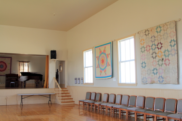
The Amusement Hall was constructed in 1895 and was torn-down in the 1950. In 2003 the Daughters of the Utah Pioneers rebuilt the structure from old bricks, using photographs and counting the number of bricks on each side of the building. The building is now available for dances, family reunions, and youth activities. And, of course, there are antique quilts displayed on all of the walls. 


There are a number of other cabins and houses around the town-site that have been restored and can be toured with a guide, or driven by on your own self-guided tour.

Ruger Dugout on the side of a hill (part sod)
Denmark Jensen Log Home
Jasper Perkins Log Cabin
Muir-Butterfield Home
Higginson-Holbrook Home
We camped two nights by the Portneuf River, adjacent to "Idaho's World Famous Natural Hot Springs" in Lava Springs, so I decided to take advantage of the "healing waters." I don't know about the "healing waters," but after about scalding my foot in the first pool, I retreated to the fifth pool (the temperature decreases with each downstream pool) and still found it too hot for my enjoyment. (They said that water temperature in the fifth pool was 105 degrees Fahrenheit, but I think that temperature was too low by several degrees.)


Friday, September 2, 2016

RonnieAdventure #0219 - Idaho, 2016 Part 1


Franklin, the oldest town in Idaho, was settled in 1860. The residents thought that they were living in Utah Territory; but then in 1872 a survey revealed that they were actually living in Idaho Territory, just slightly north of the Utah/Idaho border. When the residents were told that they would be in Idaho when the dividing line was drawn, they decided that it was probably a blessing because they thought that the Utah summers were too hot and they were looking forward to some cooler Idaho weather.


Preston is just a short distance up the road from Franklin and was made famous by the Napoleon Dynamite movie. For years the town even held a "Napoleon Dynamite Festival" each summer. I did not drive by Napoleon Dynamite's house because it is located down a narrow road and I was pulling a travel trailer; but I did drive by Pedro's house.


The Bear River Massacre monument is located near Battle River just outside of Preston. This is the location where Col. Connors and his men attacked the Shoshoni Indians without warning at sunrise on the morning of January 29, 1863. According to Chief Pocatello's life story, about 400 Indians were killed, which is the largest documented Indian massacre in the history of the United States.

The Box Elder Treaty had promised to pay the Shoshoni Tribe $5,000 worth of food and supplies each year if they would remain on the Fort Hall Reservation, but the money and supplies were never delivered. Because the emigrant's were killing all of the game in the area, the Indians were starving. To provide for his people, Chief Pocatello and his tribe left the reservation and started demanding that the emigrants pay a tribute for safe passage through the area. The emigrants complained to the government about the tribute and Col. Connors was sent to "punish" the Shoshoni Indians, especially Chief Pocatello. 

However, Chief Pocatello and a number of his men were out hunting on the morning of the attack and not in camp to defend his people; so the soldiers killed any men, women and children in camp they could find, resulting in a "massacre unrivaled in Western History."


The Red Rock Pass Geological Site north of Preston is the location where Lake Bonneville, which covered about 20,000 square miles 14,500 years ago, overflowed its natural dike. When the dike broke, the peak flow through this valley has been estimated to be one million cubic meters per second, or about "500 times the maximum discharge on the Snake River at Idaho Falls." Today, the Great Salt Lake in Utah is all that remains of Lake Bonneville.


The Oregon/California Trail Center in Montpelier is a "living History" center where visitors can participate in a "2,000-mile, five month journey" on the Oregon Trail. Period clothing is provided and master guides take participants on a tour that includes walking on part of the Oregon Trail and a simulated covered wagon ride. The tourist brochure states that it is "a dramatic recreation of the pioneers' journey from Missouri to Clover Creek. Located on the actual Clover Creek Encampment site, the center offers visitors a unique opportunity to experience pioneer life as it was more than a hundred years ago." Since we have been on numerous historic treks in the past, we we decided to skip the "journey" and just visit the museum.

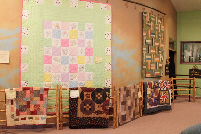
A railroad history exhibit is located in the museum basement and on the upper levels of the building there was a (you guessed it) quilt show display for the summer months.


Grays Lake National Wildlife Refuge is actually a large, shallow marsh, with very little open water because the Refuge is covered with dense vegetation, primarily bulrush and cattails. There is a wide variety of wildlife in the area and in recent years the Refuge has become an important nesting ground for Trumpeter Swans. The Refuge also hosts "the largest nesting population of greater Sandhill Cranes in the world."

There is a large hill next to the visitor center (you can drive to the top) that has a wildlife viewing scope and various information displays about the refuge. We could not see any wildlife through the viewing scope, but as we were leaving the Refuge there was a hawk sitting on a fence post and there were several Sandhill Cranes standing fairly close to the road.


Soda Springs was a favorite stop on the Oregon Trail due to the large number of mineral springs in the area where the pioneers could stop and rest for a few days. The town is also famous because it is home to the "World's Only Captive Geyser."  

In 1937, while attempting to dig a well for a swimming pool, the well driller hit a hot water geyser. The well was capped and placed on a timer, so the geyser now "erupts" to a height of over 100 feet every hour on the hour. Unfortunately, the day we visited the geyser, the timer was not working; thus, I borrowed a picture of the geyser from the web. 

Photographer Unknown


The old neo-classical Enders Building in Soda Springs was constructed in 1917 at a cost of $75,000. In 1997 the building went through a one million dollar renovation and is now used as a bed-and-breakfast hotel, museum, restaurant and gift shop. 


Located just down the street from the hotel is the Eastman Drug Store, Idaho's Oldest Drug Store (founded in 1884). They also have some nice painting on the side of the building and two old firetrucks in the parking lot. 


The Presbyterian Church was constructed in 1885 from dressed rock that had been purchased to build a railroad roundhouse. When the Union Pacific Railroad changed their plans, the dressed rock (valued at $1,000) was donated to the church.


The Dinkey Engine that was used to haul supplies to the Alexander Reservoir dam site in 1924 is now located in Corrigan Park. Unfortunately, the Dinkey did not get moved from the bottom of the reservoir in time and was trapped by rising water when the reservoir filled. It sat at the bottom of the reservoir for 52 years; then in 1976, the reservoir was drained for maintenance and Dinkey was recovered and restored by the Union Pacific Railroad. 


In 1861, while on a wagon trip west, one man's horses wandered off during the night. In the morning the wagon train left the family to find their horses and told them where they were going to camp that night. When the family did not arrive in camp, several men went back and discovered that the family had been killed by Indians. Because there was not time to construct caskets for the family members, the entire family was placed together in their wagon box and then the wagon box was buried. The grave is now known as the "Wagon Box Grave."


Adjacent to the cemetery is a Father Pierre-Jean De Smet statue and several informational displays. 

As a young man Pierre-Jean De Smet emigrated to the United States from what is now Belgium and joined the Society of Jesus, a Catholic religious order commonly called Jesuits. During his lifetime, Father De Smet traveled all over western United States establishing Indian Missions. He spent part of 1881 and 1882 in Soda Springs.