Friday, June 22, 2018

RonnieAdventure #0313 - San Pedro, California 2018


Vincent Thomas Bridge - Picture by Regular Daddy, GNU Free Documentation License
The Los Angeles Maritime Museum is located in the old Municipal Ferry Terminal building adjacent to the main channel of the Los Angeles Harbor in San Pedro. The terminal building was designed in the Streamline Moderne style and constructed in 1941 by the Works Project Administration (WPA).  

In 1963 the Vincent Thomas Bridge* was build and ferry service was abandoned across the Los Angeles Harbor. The building was then used by the LA Harbor Department until 1979, at which time it was turned over to the City of Los Angeles Department of Recreation and Parks. The Parks Department remodeled and converted the building into the Los Angeles Maritime Museum, which is now the largest maritime museum on he West Coast.   

The museum contains a large collection of maritime documents and exhibits, a fabulous collection of model ships, commercial diving displays, and various exhibits about the once thriving San Pedro fishing industry.

Models ships of the Los Angeles, Nimitz, and Nevada are all part of the Navy exhibit, which is currently being renovated. 

*(The Vincent Thomas Bridge was the first welded suspension bridge in the United States and is the only suspension bridge in the world supported entirely on piles.)


The Poseidon model that was used in the 1972 movie The Poseidon Adventure is on display (right-side up) on the second floor of the museum.


The historic section of the museum includes a model of the English Tea Clipper Cutty Sark. Cutty Sark was the most famous of  the tea clippers because the ship's construction started the transition of ship building from wood to iron. The ship was built with an iron frame and Teak wood siding. Launch date of the Cutty Sark was November 23, 1869. 

By 1895 English sailing ships were replaced with steam ships and the Cutty Sark was sold to the Portugese to haul freight to various ports around the world. By 1938 commercial sailing ships were taken out of service, so the Cutty Sark was donated to the Thames Nautical Training College where it remains today.


A history of commercial diving in the Los Angeles Harbor is presented along with some of the original equipment used by the divers. Historically, commercial divers have been used to support the fishing industry, marine salvage, Department of the Navy, and ship husbandry. (It did not say what "ship husbandry" entails.)


When the fish canneries were operational, fish were cleaned by women working at long tables before being machine processed. Pete Bosnich, Supervisor of the Maintenance Department for Star-Kist, is quoted as saying "If the fish was right - if it was a big fish - there was no way the [canning] machines could keep up with the ladies. No way! No way!"


Photographer Unknown
Throughout the building there are a variety of other interesting maritime related exhibits. 


Adjacent to Harbor Boulevard and in front of the museum are various memorials and other ship displays. 


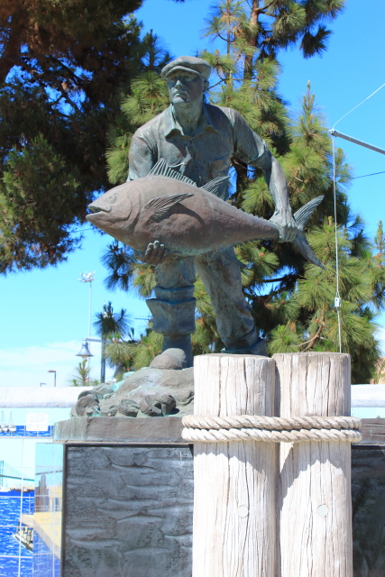
Port O'Call Village is located a short distance from the Maritime Museum and contains a number of stores and restaurants. There was reported to be a replica of the the famous "Fisherman" statue of Gloucester, Massachusetts, in front of the center; but I could not locate the statue. I did, however, locate the San Pedro Fish Market, which reminded me why I do not like to eat fish.  


Just south of the fish market are the tall ships Exy and Irving Johnson, Site of Timms Point/Timms Landing, and the S.S. Lane Victory (Victory Ship). 


In 1852 German immigrant Augustus Timms started to develop the Los Angeles harbor by construction of a wharf, warehouse, corral, and other facilities to service the shipping industry. Stage coach service was also available to downtown Los Angeles. The area was original known as Timms Point, but was renamed Los Angeles Harbor after the area was developed with additional commercial businesses. 

Since I had previous toured the S.S. Lane Victory (Victory Ship), I just took a quick picture of the ship from the dock. (see RonnieAdventures #0094 and #0133 - #0135)


Saturday, June 16, 2018

RonnieAdventure #0312 - Emigration Canyon, Morgan, Devil's Slide, Utah

We have driven by the Emigration Canyon Road on numerous occasions, but we have never left the freeway to take the short trip through the Canyon. Since we were in no rush on this trip, we decided to drive from the freeway exit at the top of the hill down to the mouth of the canyon.

Camp Grant is located a short distance from the freeway and was originally established by the Donner-Reed party in August of 1846 as a good place to stop and rest. A monument by the side of  the road states that Brigham Young's party had to greatly improve the road when they arrived in 1847, but they "acknowledged with gratitude, the work performed by the Donner Party, cutting this road over the Wasatch Range from Henefer to the Salt Lake Valley. This camp was later used by thousands." 


Little Mountain Summit was the last summit encountered while crossing the Wasatch Mountains on the Pioneer Trail. There is a monument at the summit that states "From this point the trail descends northwest until it reaches Emigration Creek. As William Clayton's emigrants guide warns, 'The descent is very steep all the way.' The Donner Party passed over the summit August 21, 1845 and the Mormons on July 2, 1847." 


Toward the bottom of the canyon there is a monument recognizing Brigham Young's  "Last Camp Site" on July 23, 1847. Brigham Young and his party entered the Salt Lake Valley on July 24, 1847.


At the mouth of the canyon is one of the strangest markers. Apparently when the Donner Party reached the mouth of the canyon, they found the creek that they had been following was blocked by boulders too large to move. They decided the only thing to do was to cut a road up the side of the mountain and get to higher ground. The monument sign states that "...every yoke of oxen was required to pull each of the party's twenty-three wagons up the hill. After this ordeal, the oxen needed rest, but there was no time. The party pushed on to the Salt Flats, where many of the oxen gave out. This caused delays, which led to disaster in the Sierra Mountains.

When Brigham Young's party arrived at the same spot, they did not want to climb the mountain; so they looked for a possible passage on both sides of the creek. It was soon discovered that by clearing less than 300 feet of brush they could bypass the boulder field. It took Brigham Young's people about four hours to cut a path through the brush and enter the Salt Lake Valley. 


After passing through the boulder field there is a monument dedicated to the Donner-Reed Party and the Mormon Pioneers. We had visited this monument on a previous trip, so we turned around and drove back up the canyon to the road that leads to Morgan, Utah.


In addition to the beautiful scenery in the canyon, there were also a number of wild and domestic flowers in bloom.


Where the road to Morgan crosses Big Mountain summit there is a monument that states on July 19, 1947, Orson Pratt and John Brown were the first members of Brigham Young's Party to climb the mountain and see the Salt Lake Valley. 


The reservoir at East Canyon State Park is a popular campground and recreation area and it was a nice place to stop for a picnic lunch.


The Browning Firearms manufacturing plant (not open to the public) is located in Mountain Green, but their outlet store is located in Morgan. It was an interesting place to visit, but I did not find any bargains that I could not pass up. 


Also located in Morgan is the historic Heiner Brothers Hotel that was built in 1890 at a cost of over $1,000 in just materials. The hotel contained a theater with a stage and in 1917 the theater started showing silent movies. In 1935 the theater was modernized with air-inflated seats and a modern sound system. The movie theater closed in 1949 and has never reopened.


Devil's Slide is a unique geological formation located east of Morgan adjacent to Interstate 84. It is reported to be one of the most photographed natural rock formation in Western United States. 

The two parallel limestone strata have been tilted into a near vertical position and resemble a playground slide; thus, the name "Devil's Slide." The two sides of the slide are about 40 feet tall and the distance between the sides is about 25 feet. No information was listed as to the length of the slide.